Maps of Genealogical Importance

Navigate this page
| Maps of Scotland | Maps of Ireland | Maps of New England | Old St. Louis |
|---|
| The Vikings | Hold | Hold | Hold |
|---|
Introduction
This section displays maps of various importance to the Robert Morrison family. Locations of counties or towns where Morrisons emigrated from and to are included.
Interactive Map of Scotland
This map of Scotland is interactive in that you can click on a county, and it will zoom into the towns. Very useful when tracing our ancestors back to Scotland. Morrisons in the US have been traced successfully back to Aberdeenshire.
Clans of Scotland
This map of Scotland shows the location and origin of the clans. The Morrison Clan was known to come from the Isle of Lewis in the Northwest.
This map shows the country of Ireland over the centuries. Of most important is Ireland in the 1600-1700, for that is when Northern Ireland was settled by Scotsmen.
Londonderry County, Northern Ireland
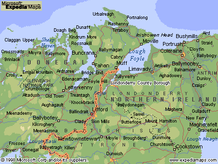 Londonderry is a county of Northern Ireland that lies between Lough Neagh and the Atlantic northern coast of Ireland. Londonderry is also the name given to the county's chief town which is both a city and a port on the River Foyle.
A close match in the DNA program points to an area called Ballymoney, which can be seen in this map about in the east portion. See Port Rush on the coast at the top. A ship left this port in 1740 bearing the Morrisons to Nottingham, no connection with Robert known at this point.
This map is useful for finding counties and their primary cities.
New England Migration
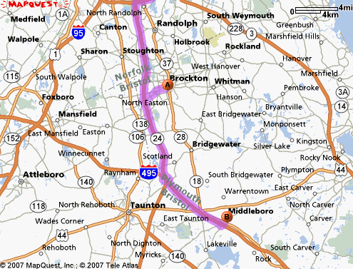
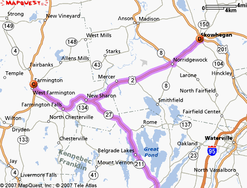
The following three maps show the migration of the Morrison family from (A) North Bridgewater (now Brockton) to (B) Middleboro to (C) Farmington, Maine to (D) Skowgegan, Maine. In Maine, one can see the other towns where relatives lived such as Madison and Chesterville.
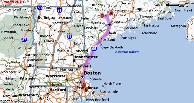
The migration from 1740 to 1800
The migration from 1800 to 1850 in Maine
Massachusetts Detail Map 1895
This file is large and make take time to load. You can see the towns of Brockton (North Bridgewater) south of Boston, and the town of Middleboro.
This link is to Pitzman's map of Old St. Louis 1868. Athlone was not a road at this time.
The red star shows where 623 Athlone Avenue is, where Keith Morrison grew up. Note the railtracks close by. Today this area is a truck depot.
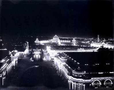
St. Louis World's Fair 1904
 This link is to the Missouri Historical Society's 1904 World's Fair Tribute. Many pictures, virtual tour, etc.
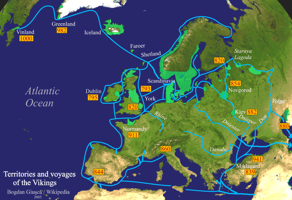
Viking History Channel website
This link takes you to the History Channel website about the Vikings.